
During the summer of 2016, the National Science Foundation sponsored me to attend the 23rd Electromagnetic Induction Workshop (EMIW2016) in Chiang Mai, Thailand. I decided to take advantage of my being in Southeast Asia to visit Sumatra. Indonesia in general is known for its many active volcanoes, and the island of Sumatra in particular is famous for Lake Toba, which is within the terrifyingly large Toba Caldera. So, I decided to check out Lake Toba as well as the nearby actively erupting volcano Gunung Sinabung.
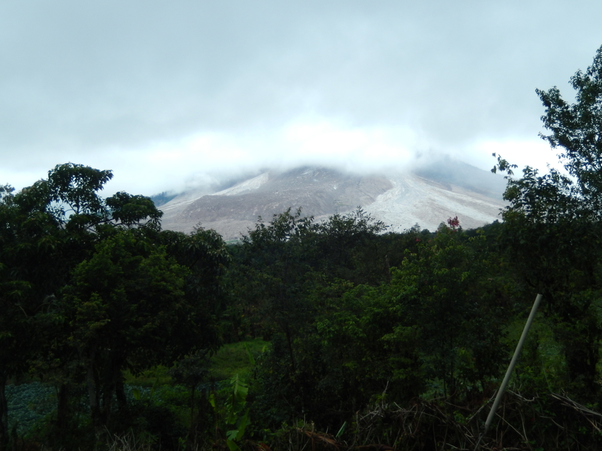
Gunung Sinabung lies to the northwest of Toba, near Berastagi (pronounced 'Brastagi' by locals) in the Karo Highlands. Another active (but not currently erupting) volcano, Gunung Sibayak, lies nearby. (Gunung means mountain in Bahasa Indonesian, the main dialect of the country.) Sinabung has been actively erupting since 2013; the volcano sheds frequent small pyroclastic flows and debris flows. Small ash plumes are spewed out almost daily. Unfortunately, thick low clouds blanketed Sinabung for most of the two days that I was in Berastagi. I could notice a fairly constant accumulation of fine ash while I was there, but I couldn't actually see the top of the mountain.
 |
 |
 |
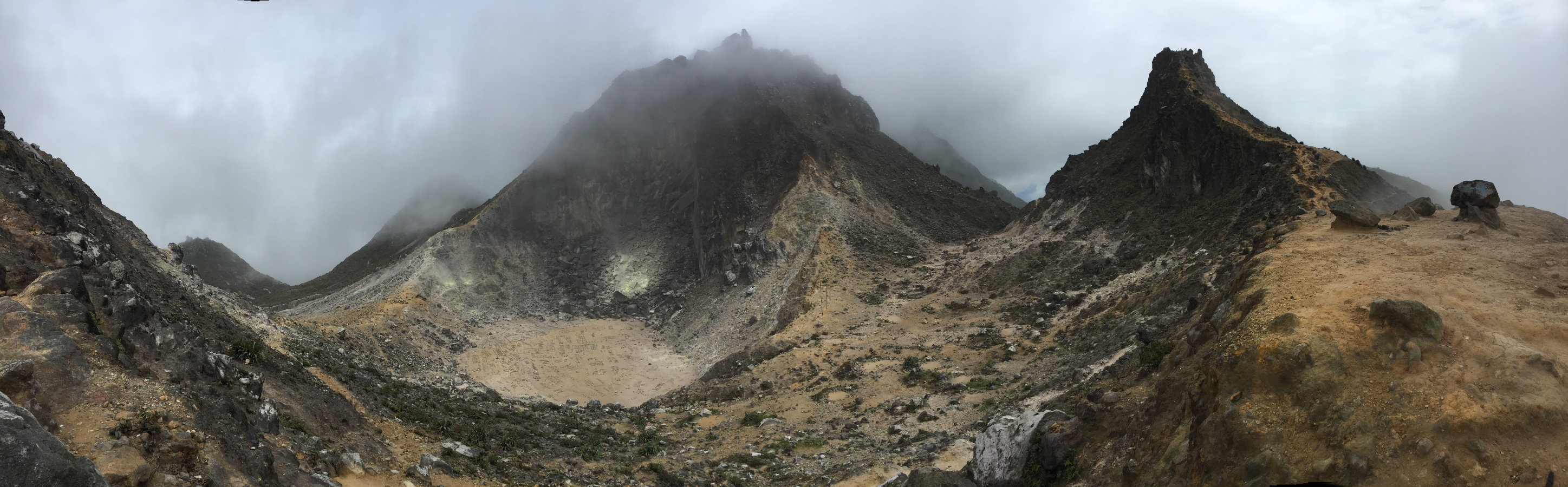
While in Berastagi, I got a local guide to lead me up into the summit crater on nearby Sibayak. Though not currently erupting, the mountain has abundant fumaroles (volcanic gas vents) that release a lot of sulfur. Locals collect the sulfur crystals that are deposited around the fumaroles for various purposes. There is also a geothermal power plant on the side of Sibayak.
 |
During my first afternoon in Berastagi, the owner of the guesthouse in which I was staying took me to the nearby Sinabung volcano observatory, which the Volcanological Survey of Indonesia had established in a two-story house to the southeast of Sinabung. (I stayed at Serdika Pavillion in Berastagi; the owners showed me incredible hospitality.) I talked for a while with the Indonesian scientists who were staffing the observatory. They maintain a limited seismometer, tiltmeter, and gas monitoring network in the Sinabung-Sibayak area. The observatory staff monitor their instruments and visually observe the volcano (weather permitting) around the clock. It is their job to keep local residents appraised of volcanic hazards.
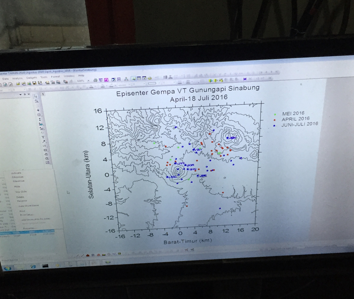
Although Sibayak is not currently erupting, the volcano apparently does share a magma plumbing system with Sinabung. The observatory scientists showed me maps of volcanic earthquake epicenters (the location of earthquakes projected onto the Earth's surface); the earthquakes occur along a diffuse zone that connects the two volcanoes. The scientists also said that gas fluxes at Sibayak changed markedly when Sinabung began erupting. Both of these observations suggest that Sinabung and Sibayak are connected at depth within the Earth.
The Volcanological Survey of Indonesia (VSI) maintains a close relationship with the USGS Volcano Hazards Program. In fact, much of the equipment that the VSI uses is given to them by the USGS. I noticed USGS stickers on several computers in the observatory.
 |
 |
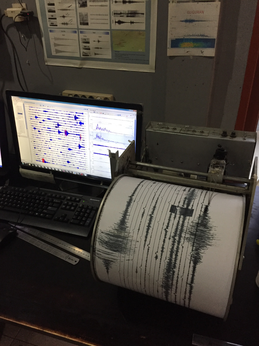 The large events visible here are earthquakes from the nearby subduction zone. |
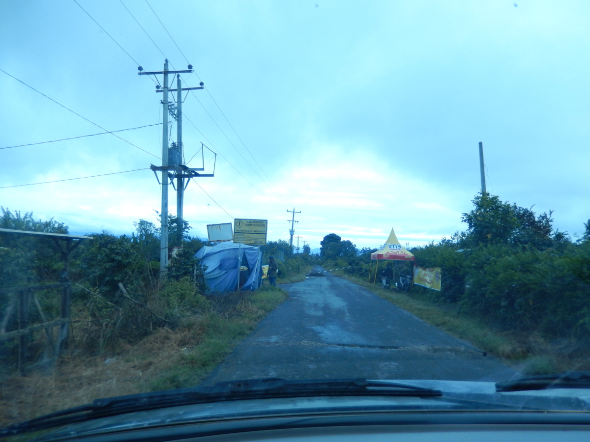
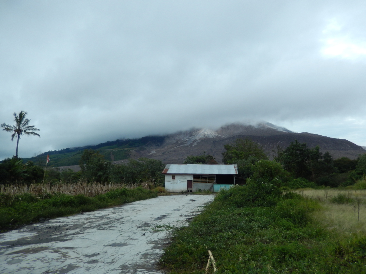
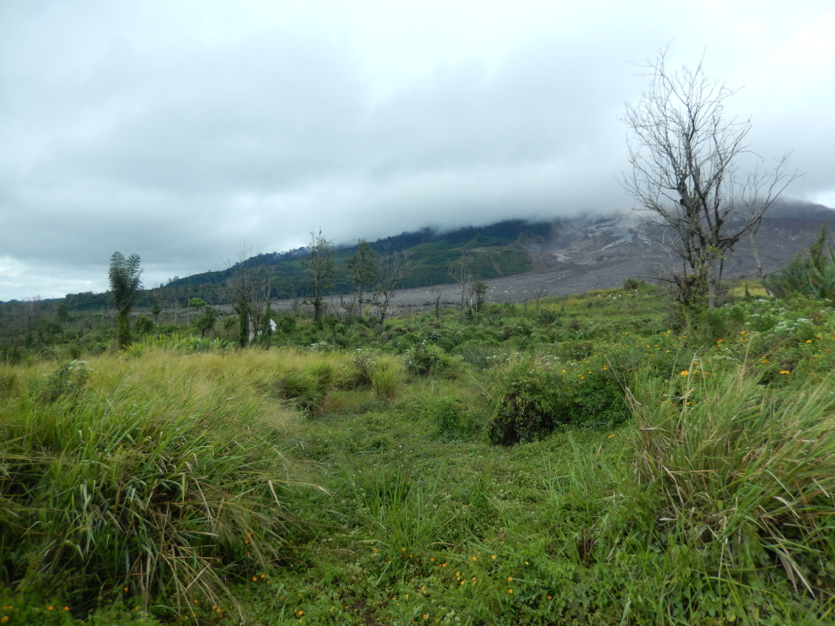
The Indonesian government maintains an exclusion zone around Sinabung in order to protect its citizens from volcanic hazards. There are two parts to the exclusion zone: the outer region, where local citizens are allowed to go during the day, and the inner region, where no one is permitted at any time due to the volcanic dangers. People who have property within the outer zone are allowed to return to their lands during the day, but they are quickly evacuated if the volcano observatory declares that an eruption is imminent or underway. The Indonesian military is in charge of enforcing these rules. I was fortunate enough to get to go into the exclusion zone, as my local guide had a permit that allowed him to take tourists in to take a closer look at the volcano. There are a few villages in the exclusion zone; they're now mostly abandoned. Rather spooky.
 |
 |
 |
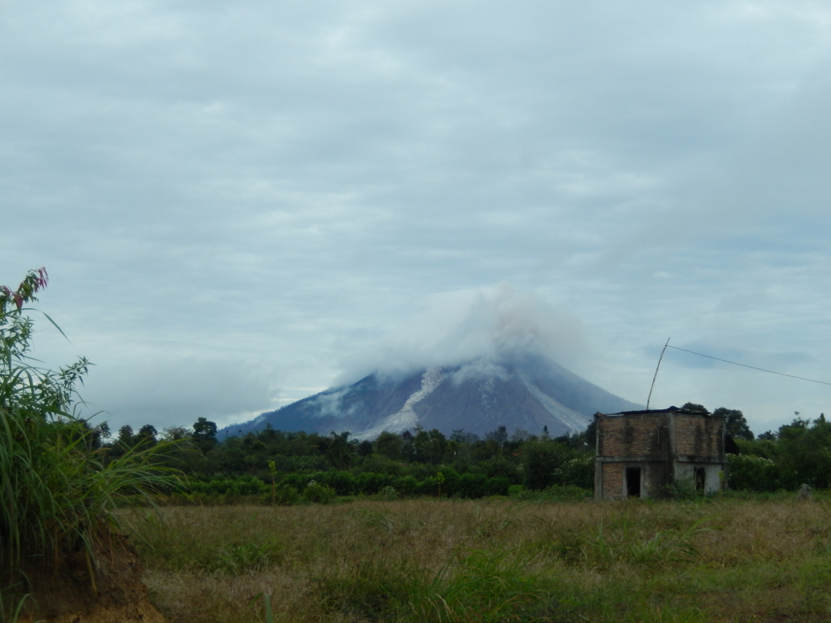
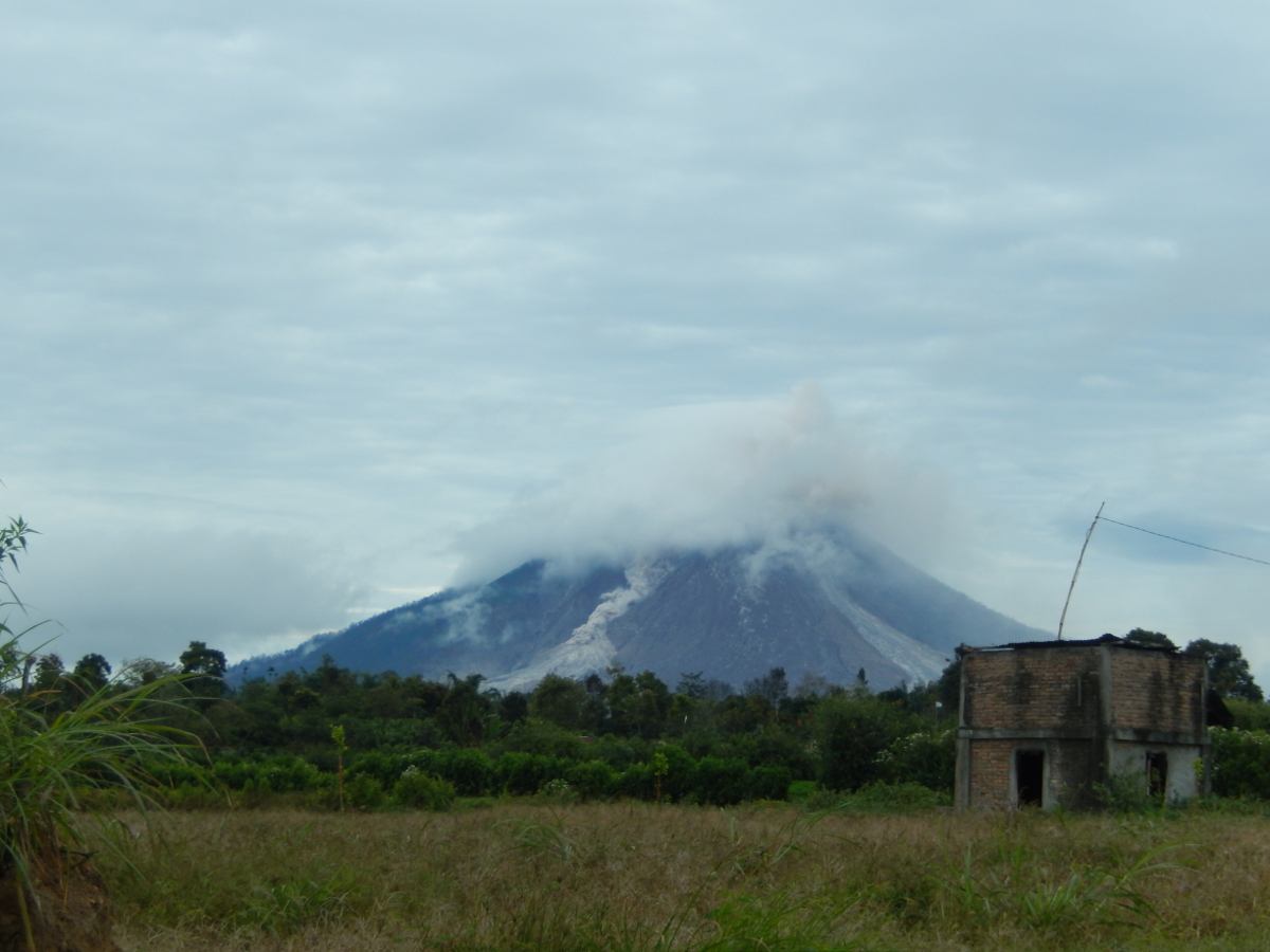
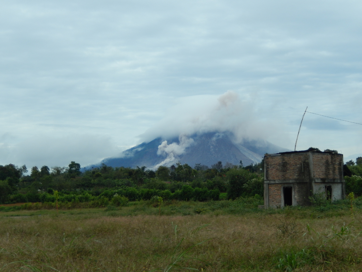
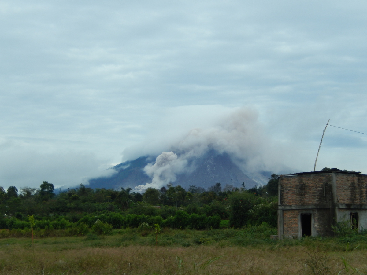
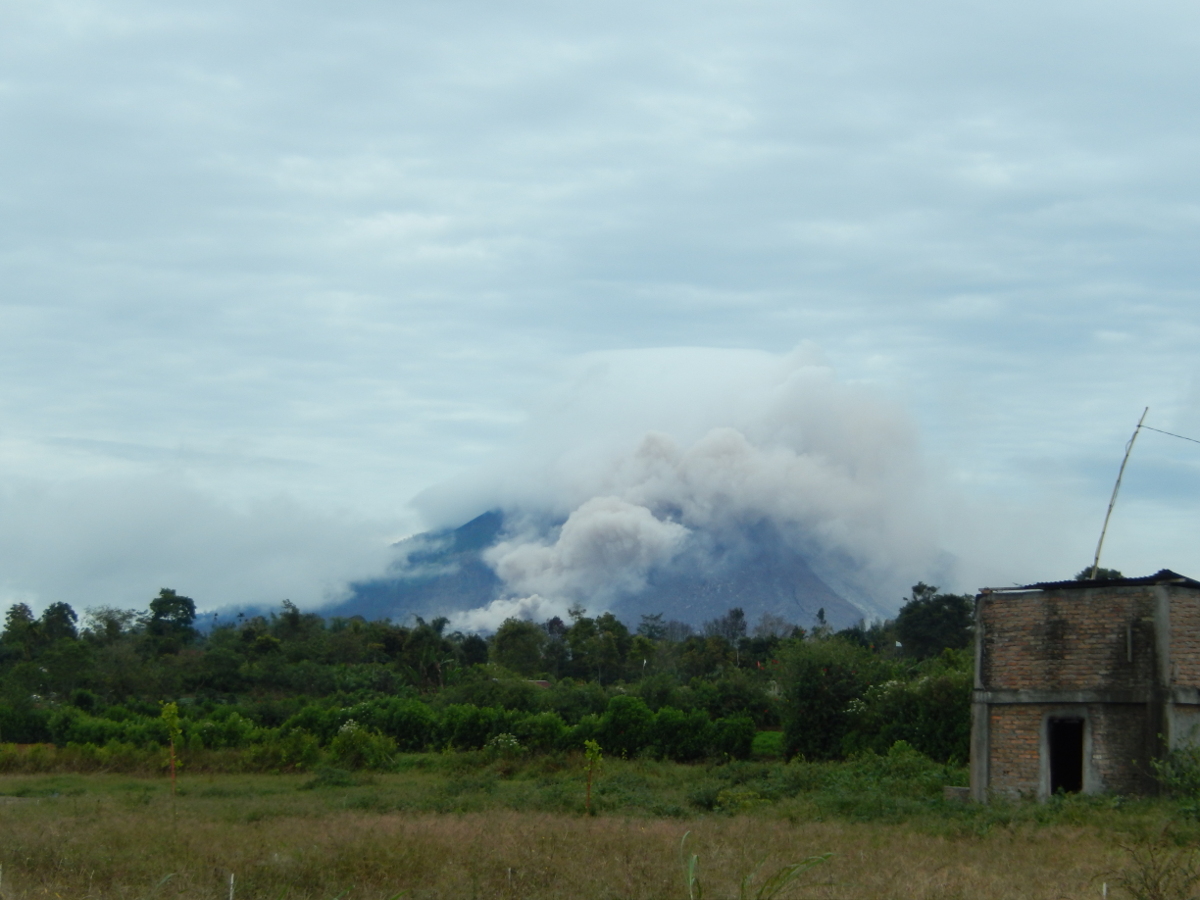
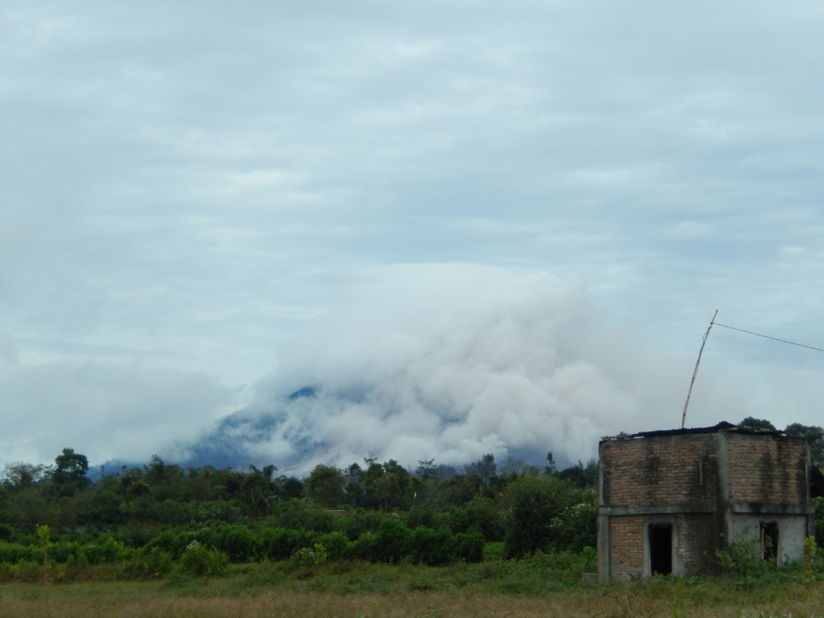
Luckily for me, as my guide and I were about to leave Berastagi for Lake Toba, the clouds cleared just enough for us to see a small pyroclastic flow coming down the mountain. The following sequence of images was taken over approximately three minutes.
 |
 |
 |
 |
 |
 |
Here's a video that I took during the eruption...
For more information about Sinabung, visit the Smithsonian Global Volcanism Program website.
Back to Rocking with the Rocks
Page created on 11/10/2016