
| Coordinates: | N/A (See Google Maps for general area) |
| Land Status: | Tonto National Forest |
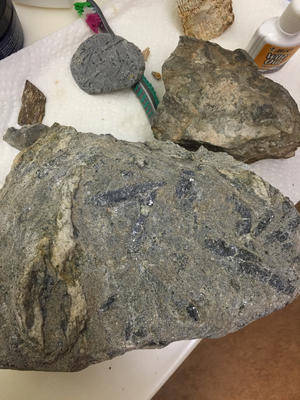
| Description: | This entry is included to encourage adventurous readers to explore the potential of this region. When I visited Hewitt Canyon, I did not have very good luck. However, further exploration up the canyon could be very worthwhile. Just be aware that the road gets rougher and rougher the further north you go. I was originally drawn to Hewitt Canyon by reports of magnetite skarns at the contacts between the Mesoproterozoic Mescal Limestone and comparably aged diabase dikes (~1.1 Ga). I explored one area where the diabase is in contact with the limestone (at roughly 478500 mE 3687000 mN on the maps below) with no success in finding a well developed magnetite skarn. However, exploration of nearby diabase-limestone contacts may turn up better outcrops. I also found abundant andalusite (?) schist cobbles in the canyon streambed. Exploring the older Precambrian Pinal Schist (specifically the pelitic subunit) further north in the canyon could therefore be a fruitful endeavor. |
| Resources: | Geologic map of the Picketpost Mountain and the southern part of the Iron Mountain 7 1/2' Quadrangles, Pinal County, Arizona (Arizona Geological Survey) Geology of the Florence Junction and southern portion of the Weavers Needle 7.5' quadrangles, Pinal County, Arizona (Arizona Geological Survey) |
Samples found as float |
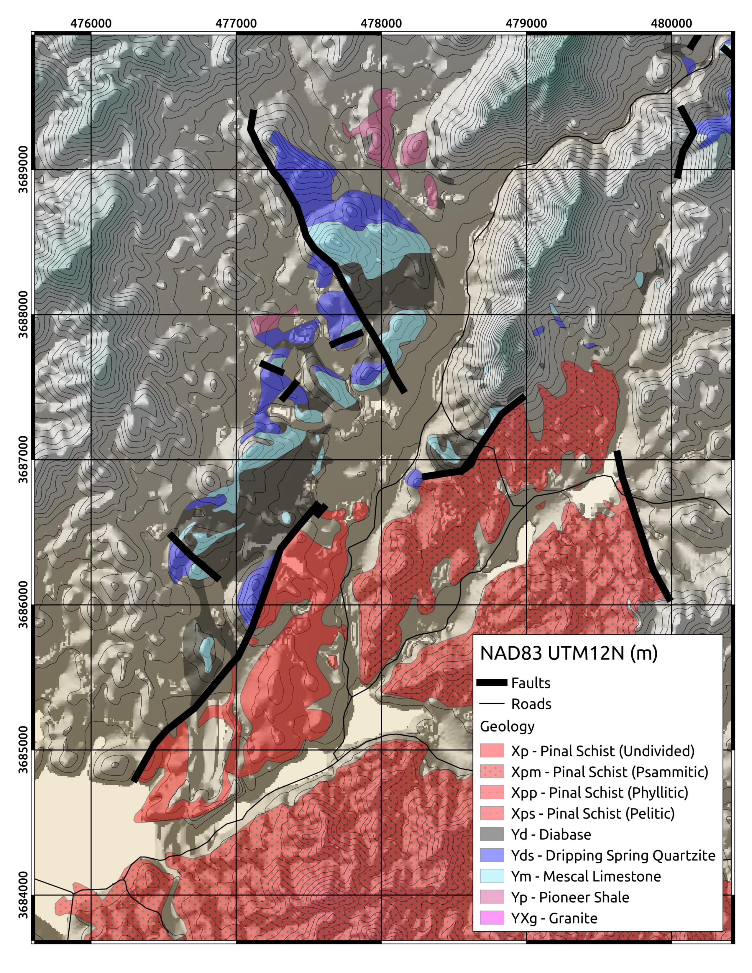 Rough geologic map (S) |
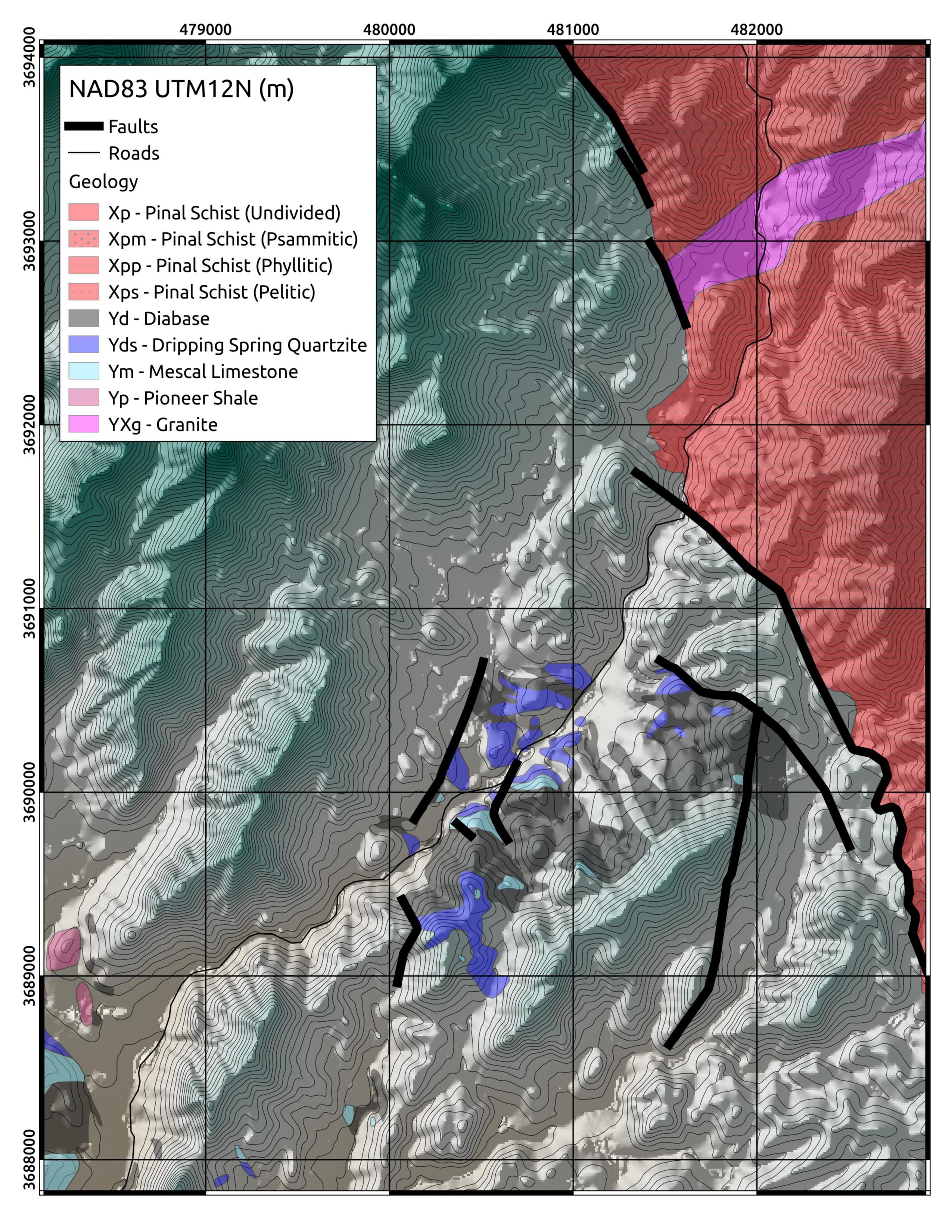 Rough geologic map (N) |
| Site visited on 12/28/2015 | Page created on 1/25/2016 |