
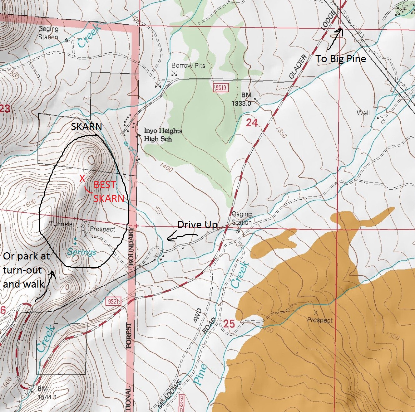
| Coordinates: | 381784 mE 4111996 mN 1519 m (UTM11N NAD83) (Google Maps) |
| Land Status: | Inyo National Forest |
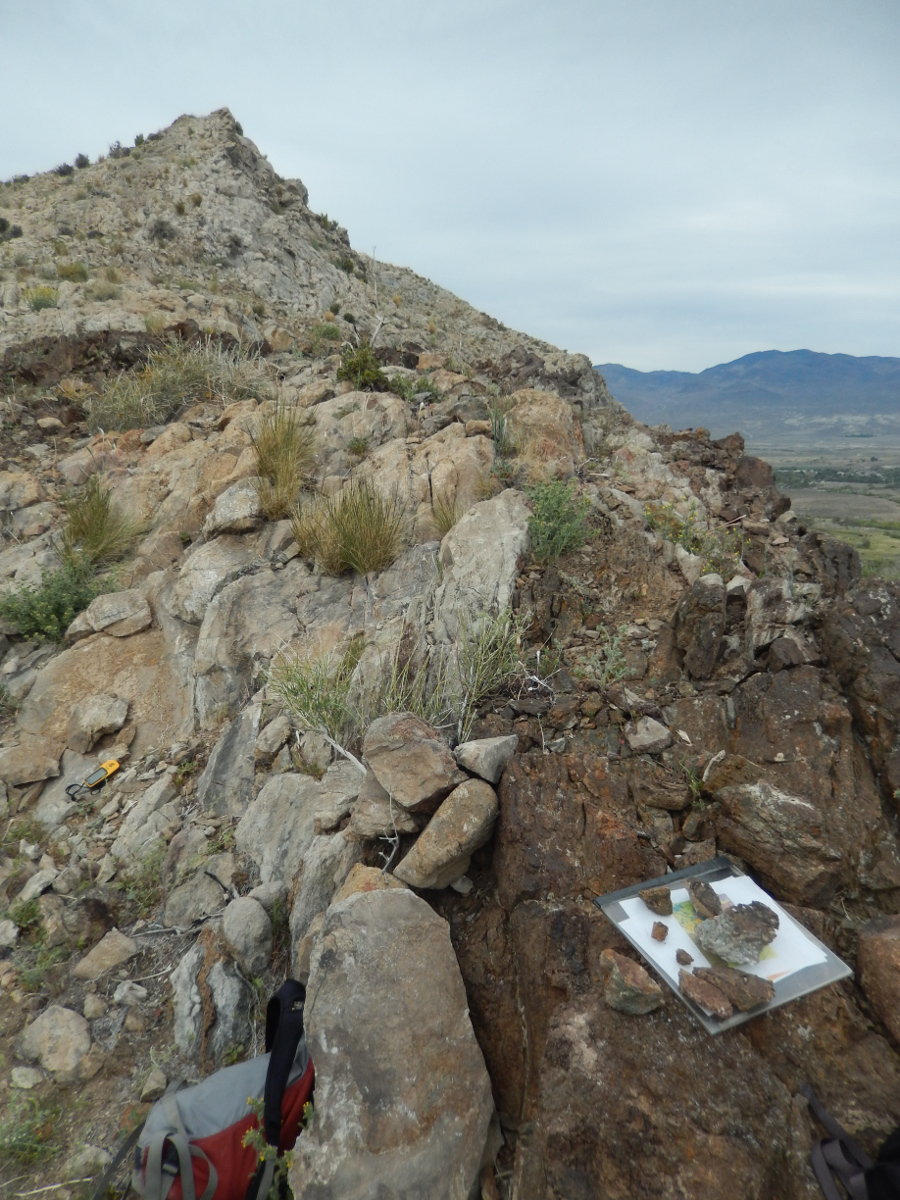
| Description: | This is a nice little skarn locality, although it is not as spectacular as the nearby Tungsten Hills skarn. The calc-silicate contact zone here (in which the original calcareous sedimentary rocks were contact metamorphosed by an igneous intrusion) is small, but it does host nice red andradite and green-yellow grossular crystals (two members of the garnet family). These crystals are up to half a centimeter across. When I visited this locality, we parked at the hair-pin bend in Glacier Lodge Road and hiked out to the contact zone. This approach is straightforward, but it involves a lot of elevation loss and gain. (Note that the elevation values in the topographic map below are in meters.) It would be far easier to utilize the network of dirt roads that branch off of Glacier Lodge Road to the east of these hills. However, I'm not sure about the quality of those roads or whether they're actually accessible. While the skarn itself is on public land (National Forest), the majority of those spur access roads are not. Regardless, it would be worth trying to utilize those roads. You would end up parking at some weathered foundations near a set of old prospects at the base of the hill. (These are on National Forest land. The prospects here appear to be currently under claim.) From the prospects, there is a vague trail that ascends the hill to the contact zone. (See the pictures below.) |
| Resources: | Geology and Tungsten Mineralization of the Bishop District, California (USGS Professional Paper 470; Plate 4) |
The Outcrop |
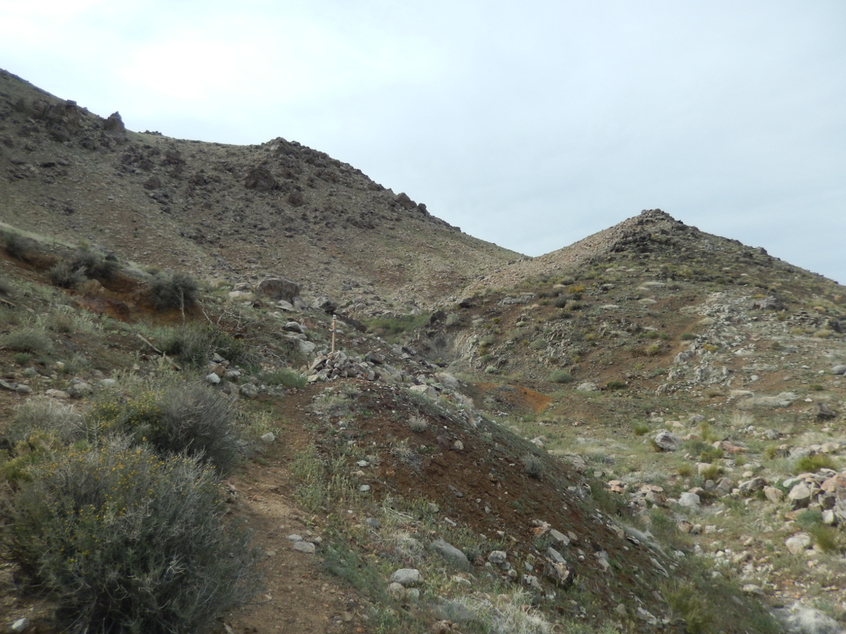 Prospects and the Vague Trail |
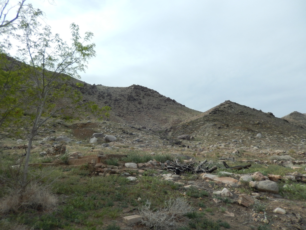 Prospects and Ruins |
 Andradite and Grossular Garnets |
 |
 |
| Site visited on 4/7/2016 | Page created on 7/17/2016 |